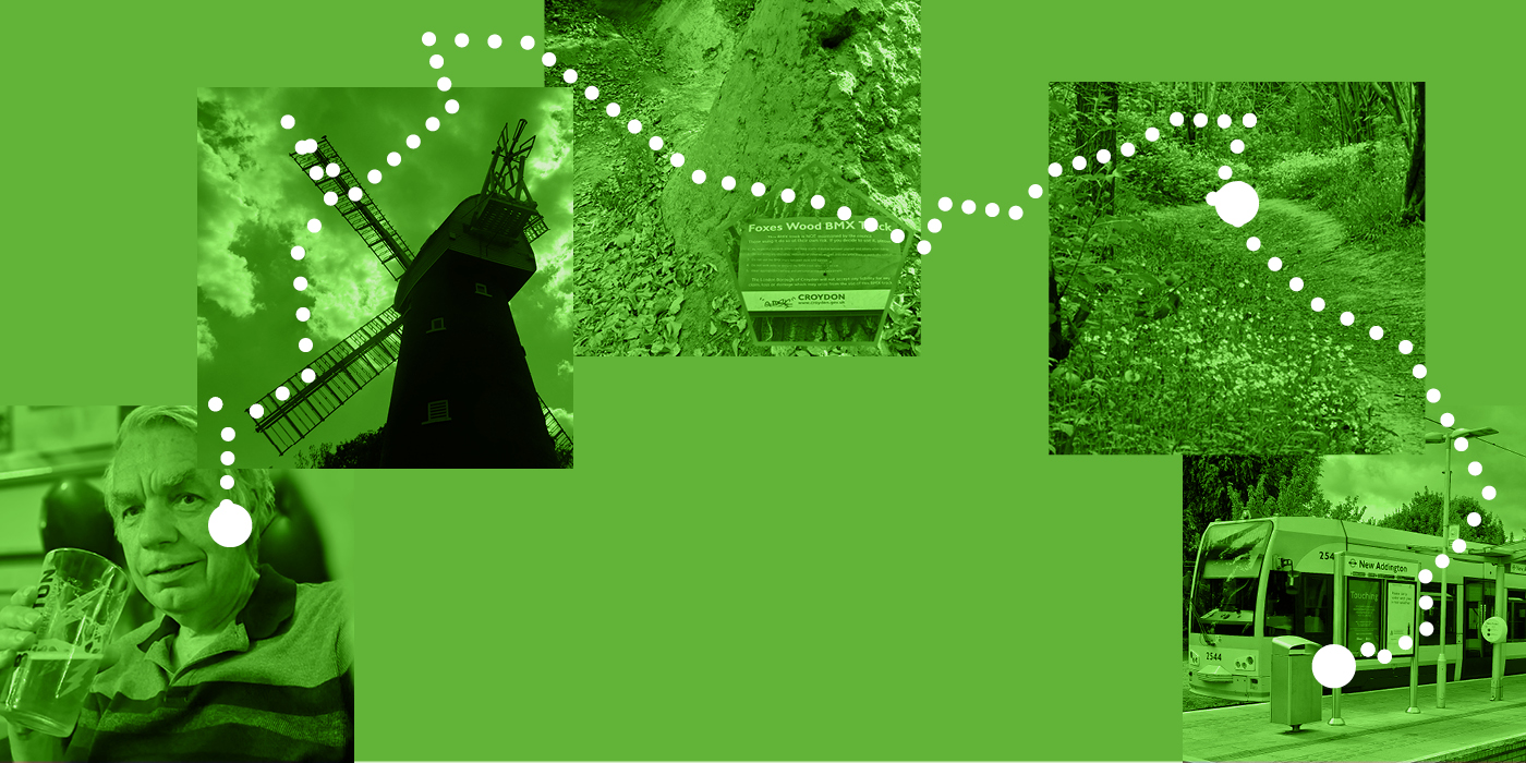
It’s a new year (if we’re talking schools) and I don’t think many adults shake that back to school vibe that September brings. Here our guest writer Peter Hall takes us on one final Green Line walk as summer officially draws to a close – this one, dubbed ‘the explorer walk’, starts at New Addington tram stop and brings us all the way to Coombe Lane, with breathtaking views, nature, a windmill, a bike track and more.
I believe that the tram line is one of Croydon’s greatest assets. The green logo and livery is so appropriate for a route which connects the town centre to many beautiful natural environments and makes nature accessible to all in our borough.
This walk starts at the Southern terminus of New Addington and guides you through woodland and heathland, up and down hill to end at Coombe Lane. The walks so far have been quite short and leisurely with refreshments very soon after the start. This one will appeal to the explorers in your family – perhaps teenagers with mountain bikes – who are looking for an adventure. It seems like a fitting way to end this series and perhaps a good way to mark the end of a long hot summer with restless young people in tow.
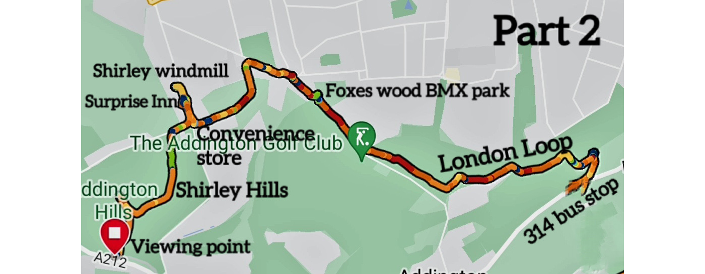
The walk can be split into two parts which are of unequal length. The first half which is only just over two miles is a walk through the woodland which borders the east side of New Addington and ends at a bus stop on the Kent Gateway. The second half is a further four miles, taking you uphill through Threehalfpenny Wood to Addington Hills, past a BMX track which is completely free to use, a convenience store selling drinks and ice cream, a pub, the Shirley Windmill ending in a final climb to the Shirley Heath viewpoint.
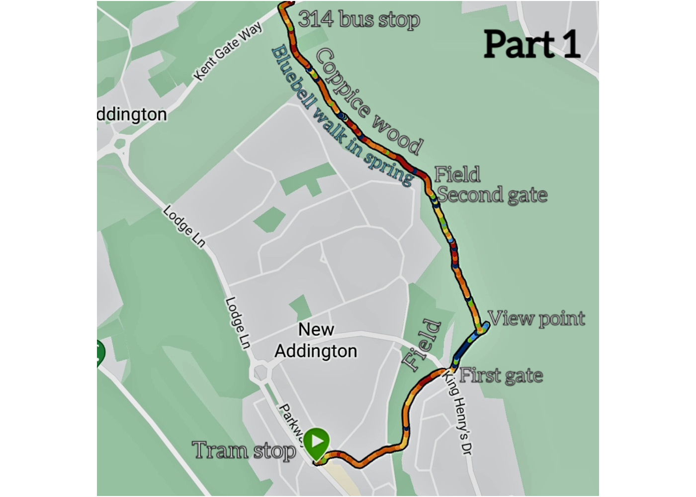
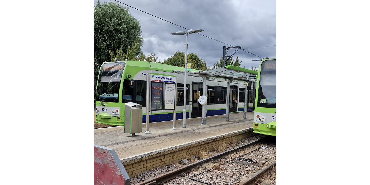
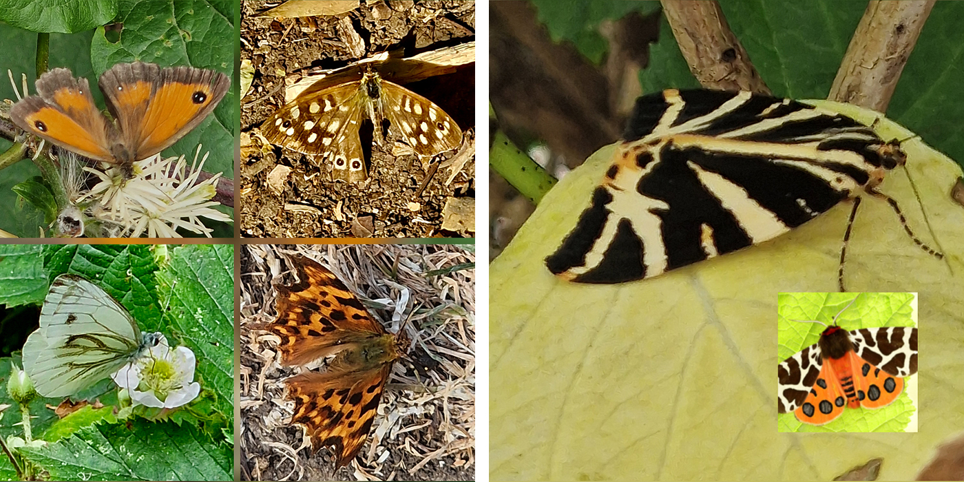
From East Croydon, catch the tram to New Addington and get off at the last stop. If you live in New Addington, this is the walk for you! Start at the tram terminus. The tram stop is on a sort of elongated roundabout with the shops on the eastern side. Walk east down the first road east – called Salcot Crescent – which runs at right angles to the tram track, away from the terminus. The pleasant tree lined residential road curves to the right, downhill. Take the second turning on the left called Ownstead Hill. At the end of this road, there is a mini roundabout. You cannot miss the surfaced footpath leading steeply uphill, across the field. At the top, turn left on the road called Goodrich Crescent-a Road in which all the residents enjoy a great view over the dry valley which you have just crossed. This road fairly quickly bends to the right and joins a main road – King Henry’s Drive – where you turn right. Almost immediately, you will see on your left, across the road, a gate and a not very promising overgrown track appearing to lead into some bushes. I think that it was once the access road for a now disused electrical substation. It is the start of our walk in the woods. Sadly, this entrance has become a dumping ground for fly tipping, but walk quickly past that and you will soon be surrounded on both sides by blackberry bushes which are a hot spot for butterflies. In this wildflower sunny spot, I found numerous little brown Gatekeeper butterflies, the incredibly restless Green Veined White Butterfly and two quite rare Jersey Tiger Moths, which have characteristic black and white wings when resting, but have most beautiful red and yellow underwings are on full display when they take to the air. If you see one, it will only be because you have seen it in flight.
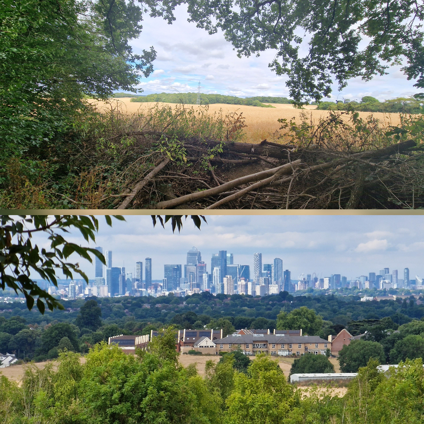
Walk on, and you are immediately in dense woodland with a track which takes you through magical archways of fallen branches. You come to a crossroad of tracks where a broad north-south track crosses your path. Cross the north-south path continuing on the original path, and you will quickly come to what appears to be a window on the eastern boundary of this strip of woodland. The gap in the canopy opens onto the edge of a field and a broad landscape. There is a sort of moat with dead branches in it. Nimble feet will not find this much of an obstacle. It is worth the effort. When you step out into the field, you are standing on an excellent viewpoint which overlooks the edge of the North Downs, the dry valley which is the route of the Kent Gateway, Addington Hills and on to the East London skyline where you will easily see the towers of the London Docklands.
Turn back along the path you came on until you get back to the junction with the north-south track. Turn right onto this track, walking north. It is a broad track. If you have children who have brought their bikes, they will enjoy cycling down it. It is not a mature woodland with massive oaks, but the spindly trees cross over your head creating a shady tunnel which is pleasant on a hot and sunny day.
The frequent sunny glades provide excellent opportunities for watching butterflies. If you have brought a camera of any sort, you will find them surprisingly difficult to photograph. Their flight path is so erratic, appearing to have no purpose and completely unpredictable. They only rest for a brief period before fluttering off again. This behaviour is their defence against predators but is also their way of scanning their environment for a mate or a nectar flower. If they are looking for love, you stand no chance – I have tried many times to capture butterflies dancing together in a sunny glade. However, if they are looking for nectar you can be one step ahead. They tend to look for small white flowers which are not that common in the woods. They tend to return to the flower they just left. Be patient and watch their behaviour and you will learn where to stand so that they will come to you.
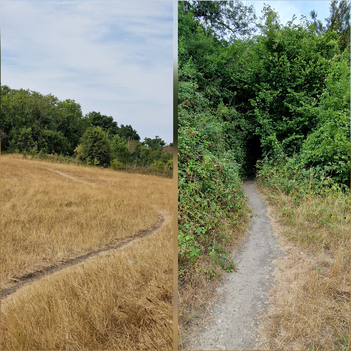
After a few hundred yards, walking (or cycling) downhill, you will come to a green gate leading onto a grassed field. Paths run in all directions. On your left you will see some houses, on your right there is a gravel roadway. Straight ahead, twisting first to the right then to the left, is an uphill path which appears to dive into a bush. That is your path, follow it! This stretch of open grassland is another haven for insects on a hot sunny day. You should find the grass full of crickets jumping away, as soon as you approach, and I found several Comma butterflies fluttering around the hedges which surround the long grass.
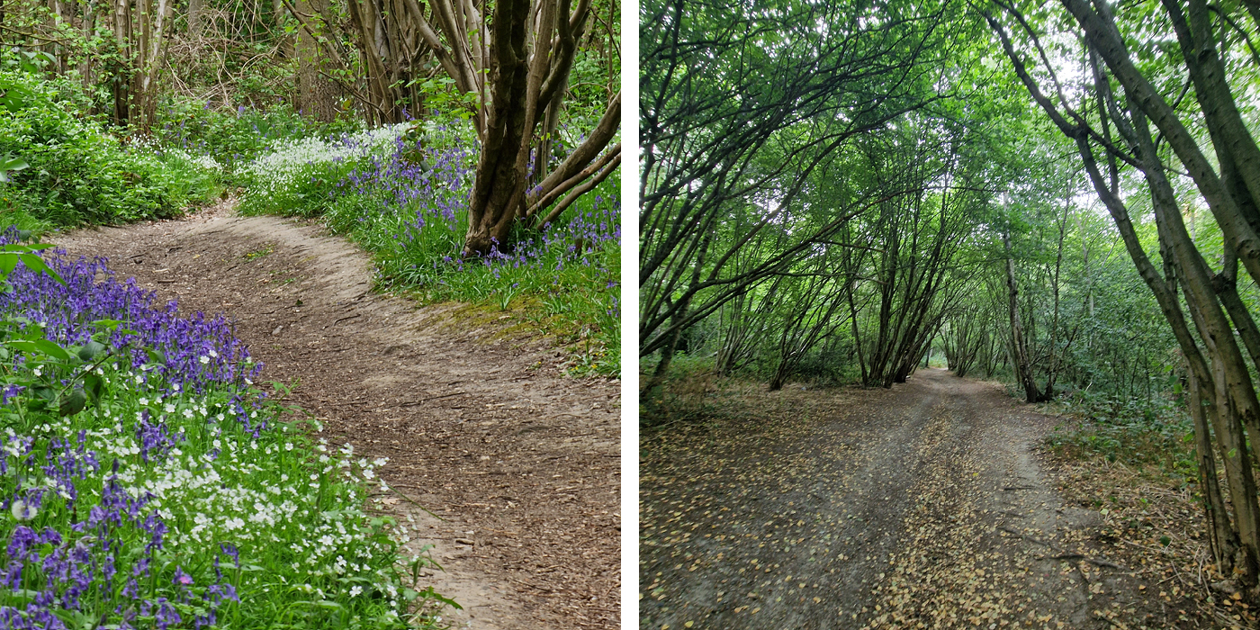
The path literally vanishes into a hole in the bush. Dive in there! It leads to another magical woodland of coppiced trees whose spindly branches meet above your head. Coppicing is the practice of periodically cutting trees down to the ground to encourage new growth for firewood or timber. You will see everywhere the evidence of our ancestors for whom this woodland was a precious resource to be nurtured and constantly regenerated.
The path continues downhill, the ground becomes sandier. At times, paths joining on the left and right give you a glimpse of just how thin this stretch of woodland is – in places no more than 100 metres. On each side there is open farmland or residential development.
Although this article will be appearing towards the end of summer, and I have most recently walked it in the middle of a very hot August, I first visited this wood in April when the bluebells were out. I would strongly recommend revisiting in the Spring of 2023. The entire path was bordered with bluebells, but even better, they mixed with white anemones. The mix of blue and white on a woodland path was probably the most gorgeous example of the bluebell season which I have seen anywhere.
It struck me that this sliver of woodland has no name, no “friends of”, is not protected in any way but has the most insect life of any part of South Croydon which I have visited and the most impressive bluebell display in the Spring. New Addington residents are very lucky to have this on their doorstep. I wonder how many know about it.
You will soon see a fence on your right, which is the perimeter of the water pumping station and a yard on your left with old cars and vans. The path has narrowed to a few feet wide and emerges onto the very busy Kent Gateway. Turn right on the footpath and walk a few metres to the bus stop.
This is the end of the first half of the walk. Unaccompanied children should be told to turn back here or catch the 314 buses to the Addington Interchange. The road is busy and needs an adult to supervise crossing it.
Across the road you will see a wicket gate leading into a field, and an up-hill path leading to nearby woodlands. Take the path and enter Threehalfpenny Wood. There is a very steep and narrow path straight ahead of you which dives into the mature woodland. Don’t be tempted to take the wider path which crosses from your left and right. It is steep, but not very long before you reach another broad path crossing the track which you are on. This path is part of the London Loop walking path which we will follow for the rest of the walk. You will see signs on posts telling you that. Turn left to follow it in a westerly direction.
Threehalfpenny Wood is far more mature than the Addington woodland. Tall trees tower above you and wide clearings have been made along the route of your path. The route is well signposted; it will curve to the right and in the end come to an open field where the London Loop signs tell you to turn left. After that, the signs are a bit vague, and I recommend a small detour from the Ring. Keep to the left of the field and you will come to another mature woodland where you will almost immediately see a clear track on the right. Follow that track which will take you through a small field, more woodland and eventually reunite you with the London Loop shortly before you come to the main road which is Shirley Church Road. Turn right and follow the broad footpath. On your right is woodland called Foxes Wood. Here, to the delight of any teenage children in your group, is a BMX track with banks and gullies for the kids to ride in and over. There is a warning that this track is not supervised, and kids need to wear protective gear. I think discreet parental supervision would be wise.
Moving on, if you can, you reach a roundabout and need to take the left (main road) exit. From here walk about 50 yards before you see a sign pointing to the London Loop which is a footpath on your left. It is a very straight level path with woodland on the left and eventually a playing field on the right, coming out into a rather quaint Shirley road, called Sandpits Road, with bungalows on the left side. Admire the quirky back gardens and porches of the residents who live in those bungalows!
You reach the main road to Shirley and on the corner is a convenience store, open on Sundays, which sells a good range of ice creams, drinks, and confectionery. There is a grassed area across the road where you can make a picnic of it.
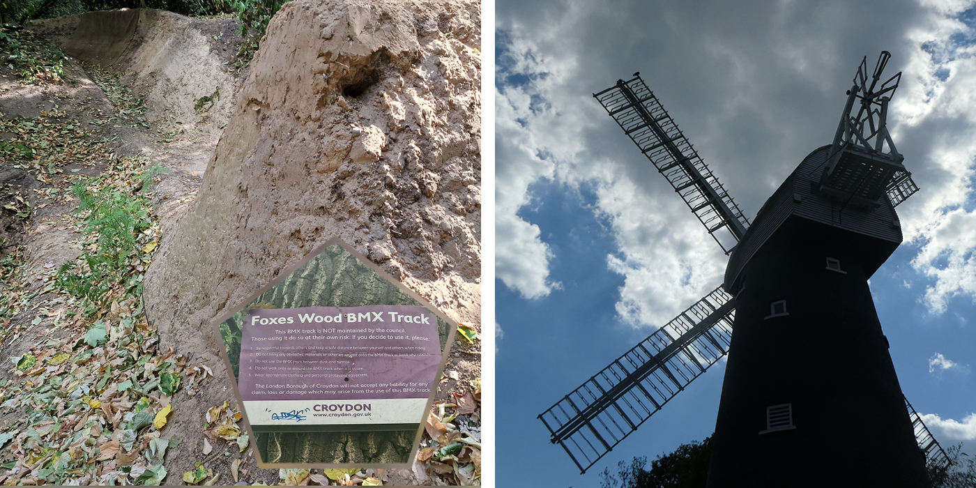
At this point – probably depending on the age range of your group – you need to decide. You can follow the London Loop which is signposted on your left just a few yards into Oaks Road. This is the quickest route to the end of the walk for tired legs. However, an all-adult group may prefer to walk downhill on the Shirley Church Road where you will quickly encounter the Surprise Inn which is also open on Sunday afternoons. It has an excellent restaurant and a good range of ales. You may need it! Walking a hundred yards further beyond the Inn and you will reach Postmill Close on which is the superb Shirley post windmill which dates to 1854. There is a website here set up by the Friends of the Mill, who plan to open once a month during the summer. Sadly, it has not recovered from the COVID lockdown and will not open this year. However, it is well worth seeing from the outside and keeping an eye on this website for 2023. When you have been wined and dined and taken selfies in front of the mill, stagger back uphill to the junction with Oaks Road and look out for the London Loop sign from Oaks Road onto Addington Hills.
This is a part of the London Loop where signage seems to evaporate. I found the exact route quite hard to find in this direction, but easy to follow in the opposite direction. Don’t worry, there are numerous uphill trails. Just keep going uphill at every turn. If you are lucky you will arrive at the brick viewing point which is the correct route. More likely you will end up on a very broad path over the gravel plateau with gorse bushes and stunted trees on both sides. This is a rare ecosystem which once covered large parts of what is now South London suburbs. The poor soil produces this interesting bush which has its own unique wildlife described on information boards. You will reach another broad track which comes from the car park on your left and leads to the viewing point on your right. Walk to the Viewing Point – iit is worth it. You will get an excellent view of the city of London, Docklands, and the new tower blocks of central Croydon in the foreground on your left. Look hard and on a clear day you will see the iconic arch of Wembley Stadium.
The final walk to Coombe Wood tram stop is a short one. Follow the path back from the Viewing Point towards the car park. You will see a pronounced track forking to the right in a sweeping curve behind a building which is a Chinese restaurant. Follow it into the woods. You shortly come to a deep hollow, veer to the left, following the perimeter of the hollow and leaving it at its far end. After a very short walk along a vaguely marked path, you will see the tram stop through the trees. Head for it! Relax on one of the frequent trams which go to New Addington and to East or West Croydon.
Sadly, this is the limit of country walks which can be done from the part of Tramlink which goes through Croydon and therefore the end of this series. If you have enjoyed these walks, I recommend future trips to venture outside the borough boundary, where you will find great walks on the common from Mitcham Junction Station, Ravensbourne Park from Belgrave Walk, Morden Hall Park from Phipps Bridge and Wimbledon Common from Wimbledon Station.
The good news is that there is an extension to these walks. The next chapter will be walks from our fantastic rail and bus network, so look out for it!

Peter at the Surprise Inn
Posted by guest writer Peter Hall (all photos courtesy of Peter).
If you missed The Green Line Part 1, you can read it here.
If you missed The Green Line Part 2, you can read it here.
If you missed The Green Line Part 3, you can read it here.
If you missed The Green Line Part 4, you can read it here.
If you missed The Green Line Part 5, you can read it here.
If you missed The Green Line Part 6, you can read it here.
Peter lives, works, walks, and often runs in Croydon – always with his camera – visiting green spaces and places with an interesting history. He is a keen Instagrammer who loves to give and receive comments on his peter_at_croydon account.


Just to let you know The FoSW did open for 4 Sundays . We listed on Eventbrite for the 1st Ttime for booked toura rather that our usual just turn up for tours. So far this has neen a blessing and a curse. Fully booked or at almost wehad 60 no shows for August but made up by people just turning up the next two were aroind 20/0 no shows and with people again coming along we did OK. We will see what happens tomorrow we have 129 booked! May well update you later. Weather may be against us on Sunday. Very many thanks for the mention. Tony Skrzypczyk Secretary FoSW